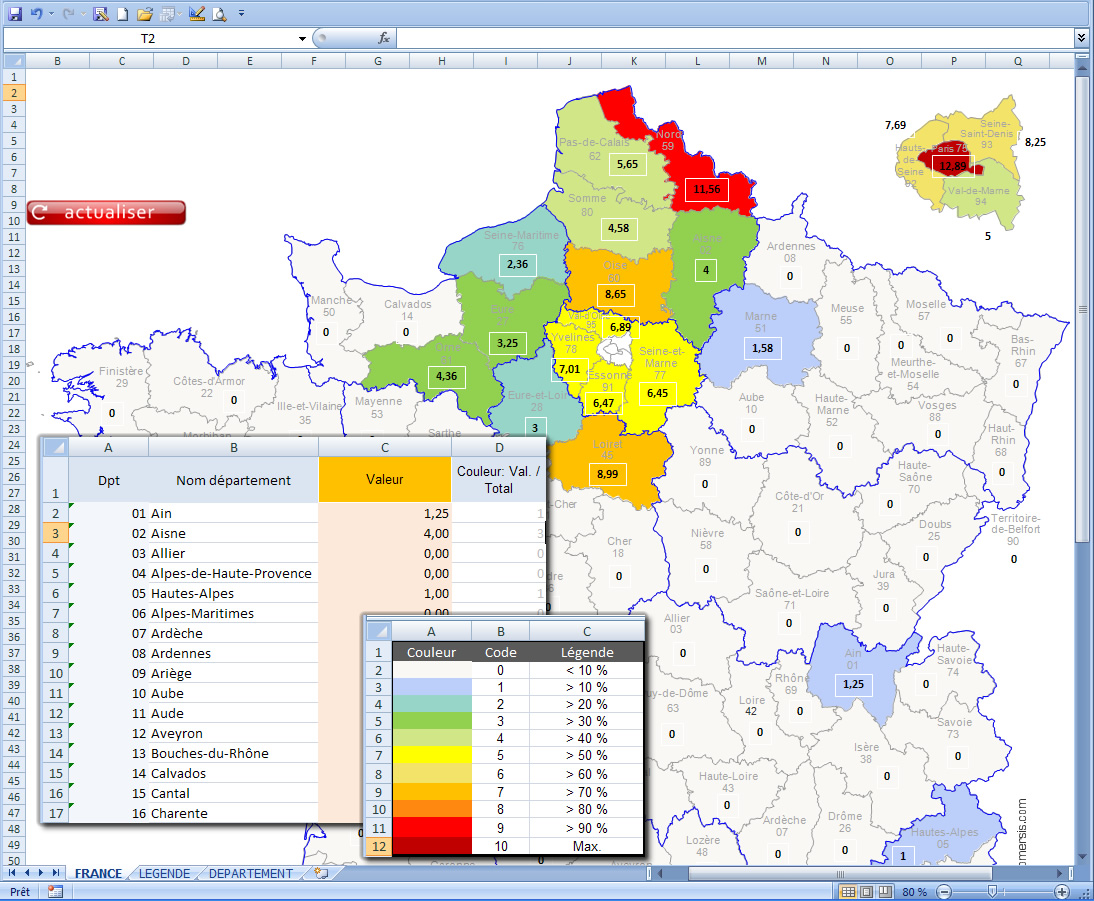
 click on the map to enlarge
Map of France for Excel : check your datas, select your colors and that's it !
3 maps pack: departements,regions 2015 and new regions 2017.
Présentation
Caractéristiques
Formats de fichiers *
 Editable
 Excel-2007
 Excel-2010
 Office
* Liste des fichiers contenus dans ce téléchargement.
Produits complémentaires
Carte Circonscriptions de France Excel choroplèthe (macro vb)
Carte Excel macro des circonscriptions de France avec identifiant des 577 circonscriptions législatives, code vba interagissant avec la carte, légende par palette de couleur modifiable.
Carte Zones d'emploi Excel macro
Carte Excel automatique des zones d'emploi en France.Utilisation / Aide
Retrouvez nos tutoriaux sur la Faq Comersis.com