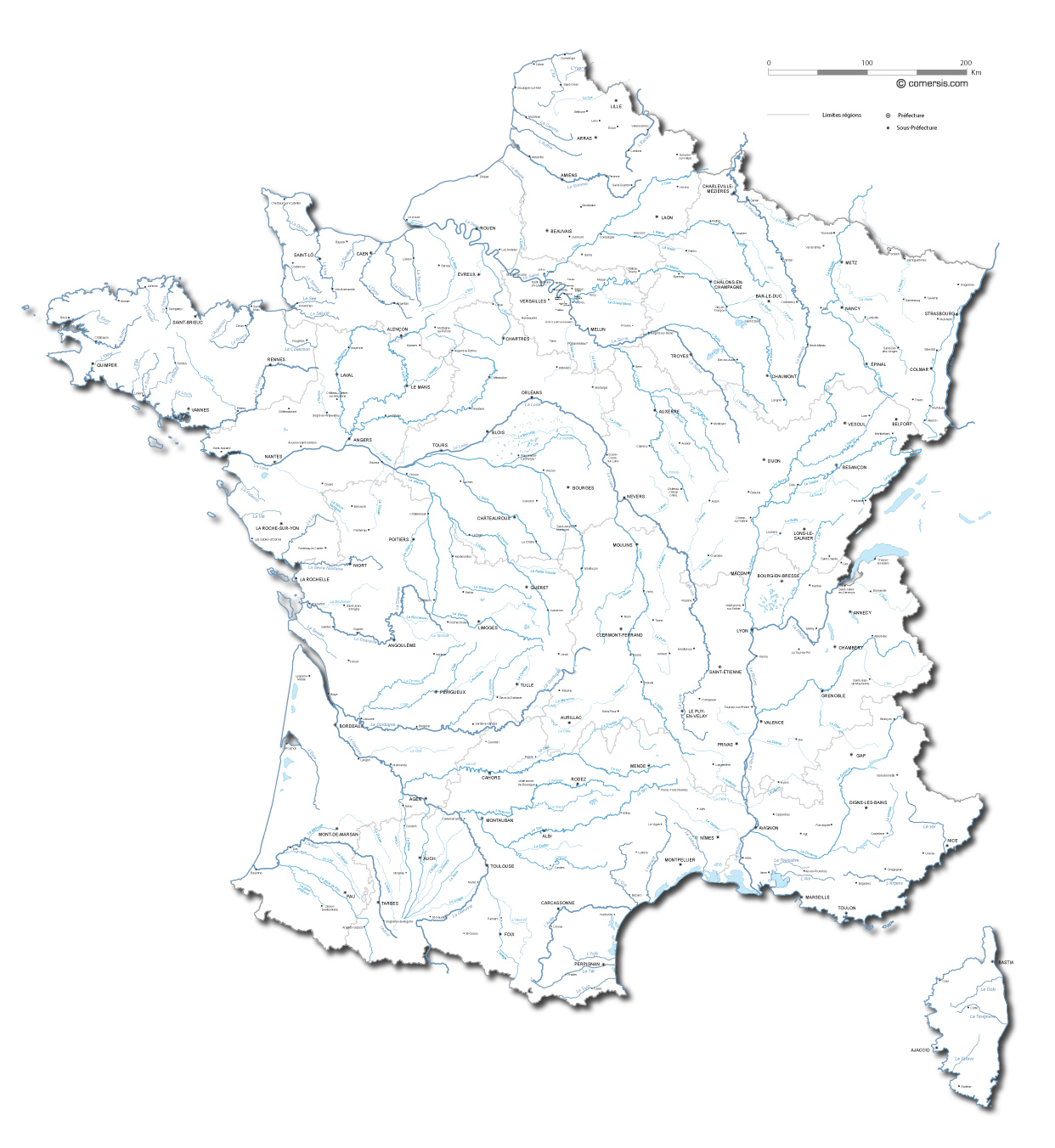
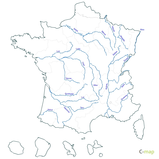
Customizable vector mapping of rivers and streams over 100 kilometers in metropolitan France.
Map set of the new regions, departments, head towns of France ready to change for ms office Word®, Excel® and PowerPoint®.

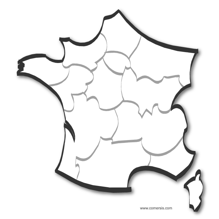
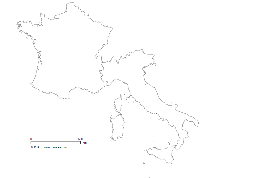
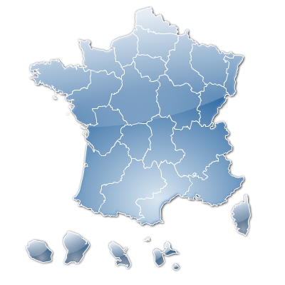
Customizable base map of the borders of France, Italy and Switzerland.
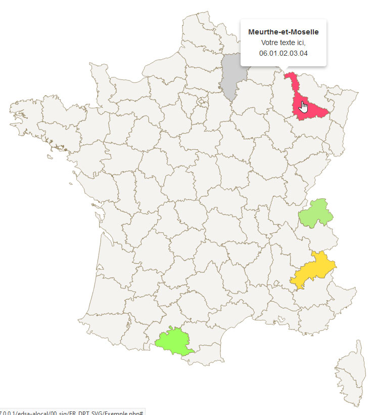
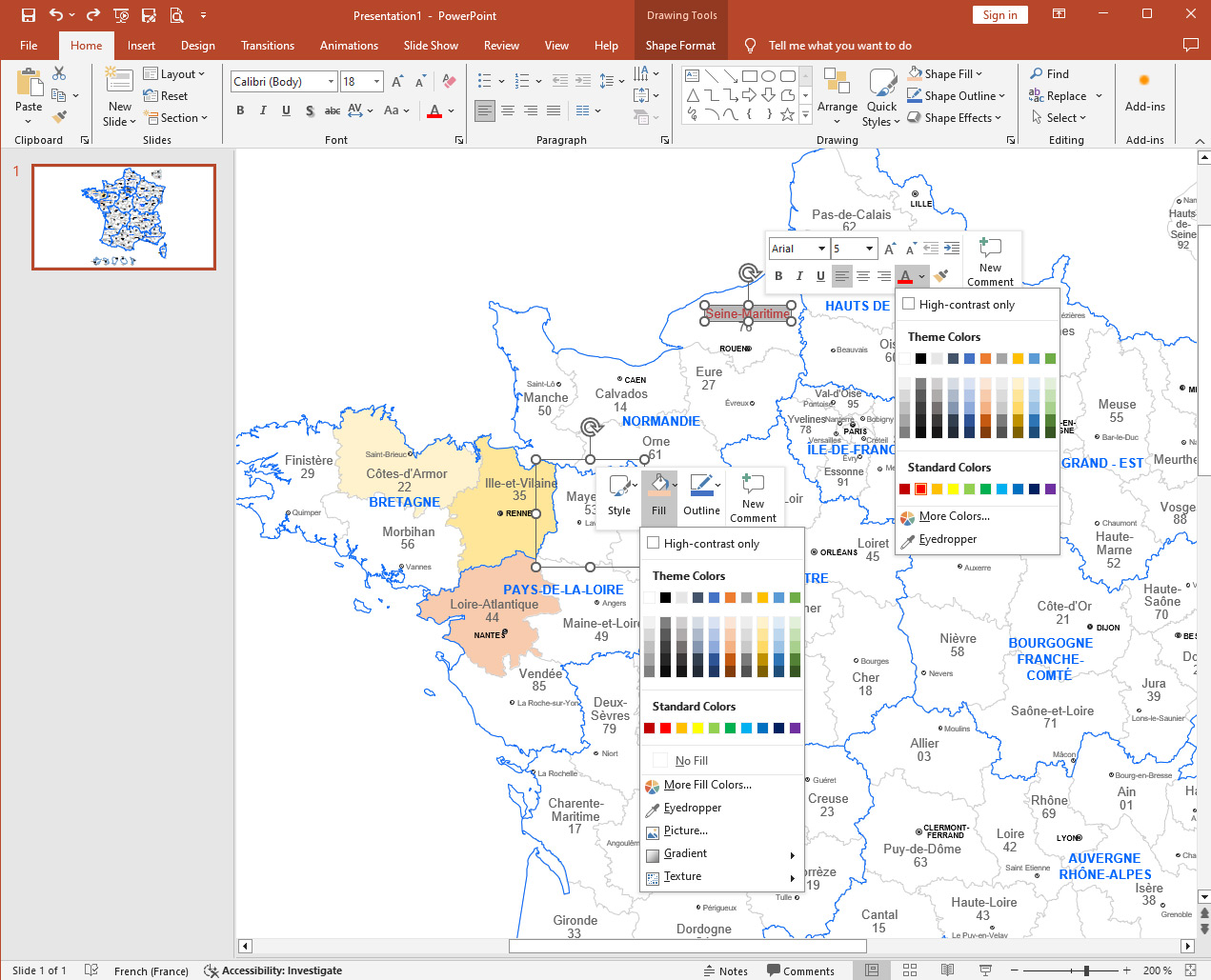
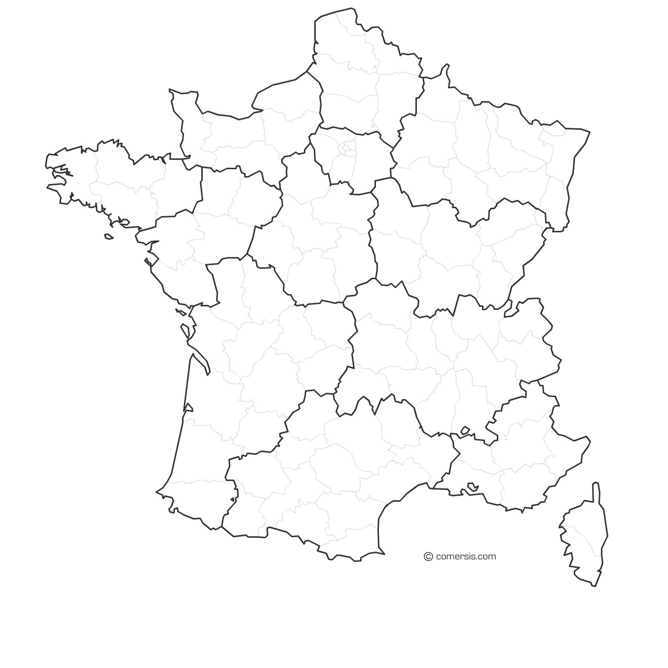
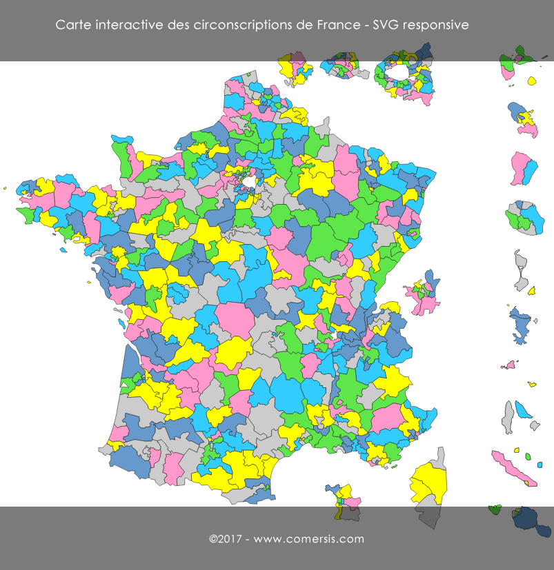
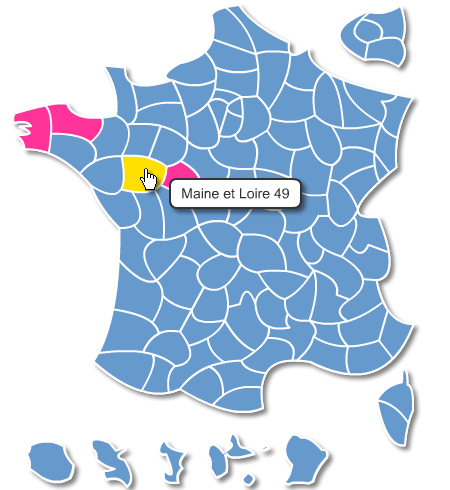
Interactive map with full administration for coloring, opening links on new pages, editing text.
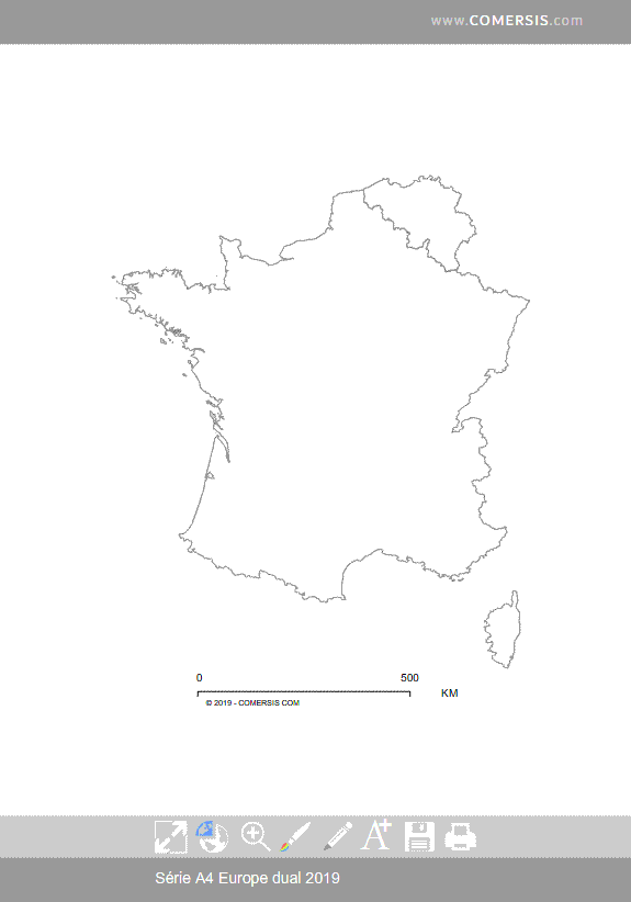
Editable map of french old departments for Word, Excel and Powerpoint 2007/2010, 2016/365.
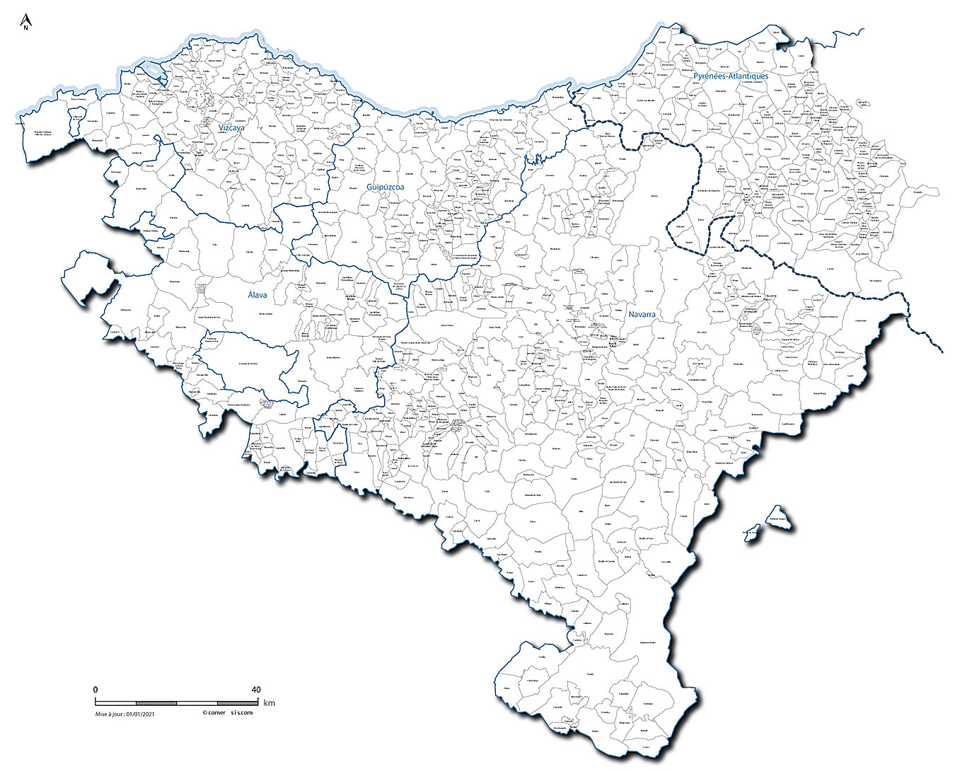
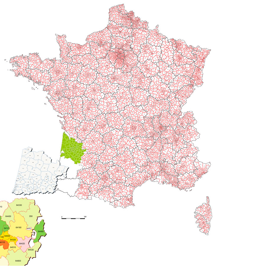
Vector map of the municipal contours of the Basque Country with the name of the municipalities, provinces and departments.
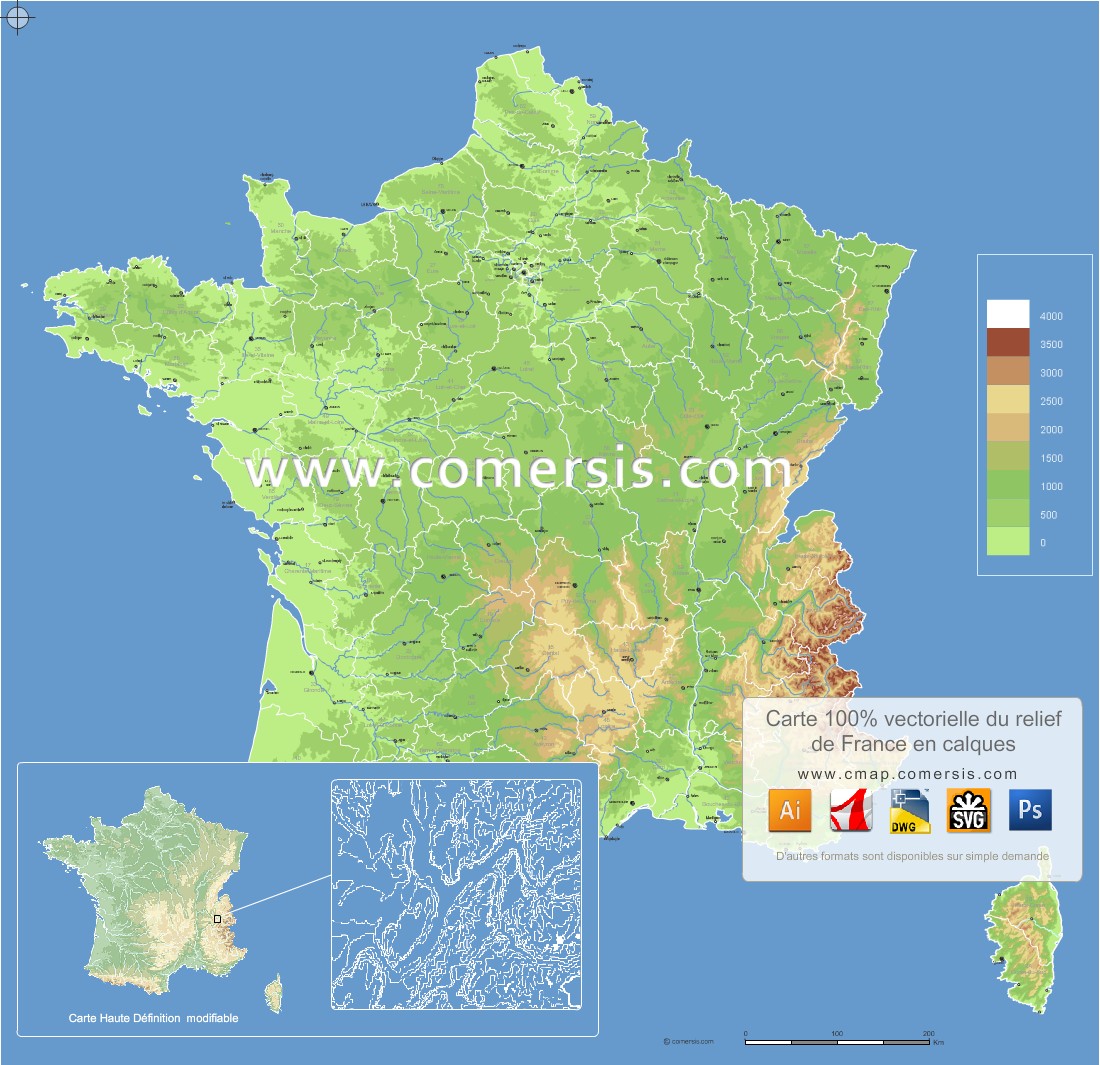
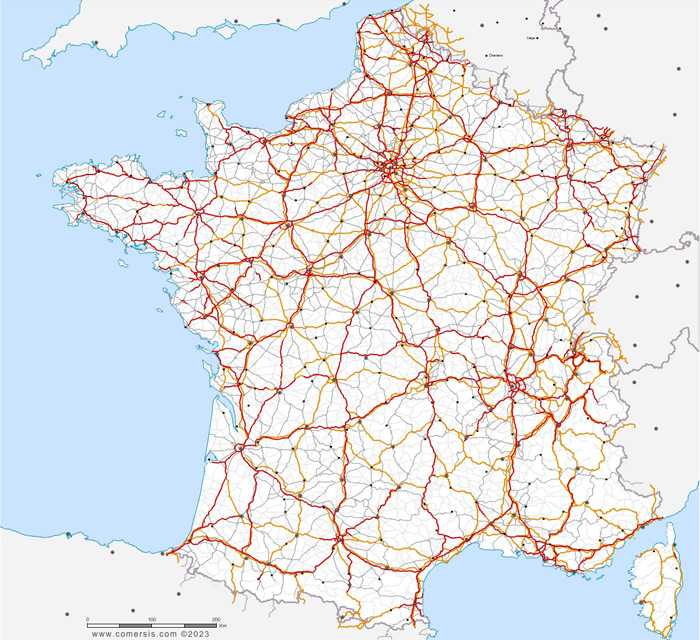
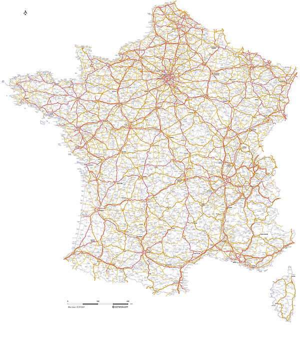
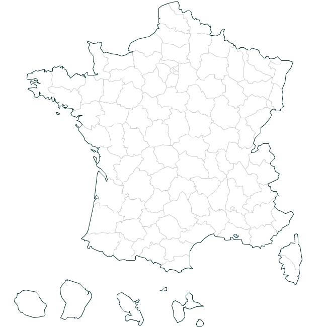
Vector map of the reliefs of France built in editable layers.
This map is part of the L2011 Series compatible with the other layers such as roads, traditional countries, counties and regions, communanutés municipalities, cities ...
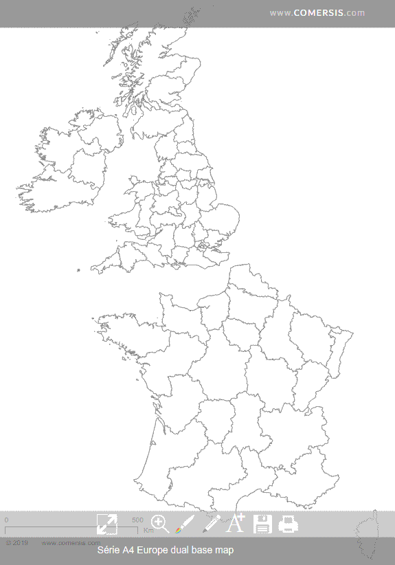
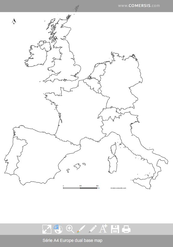
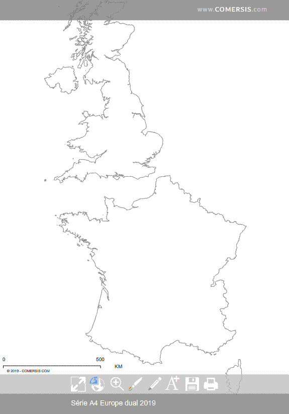
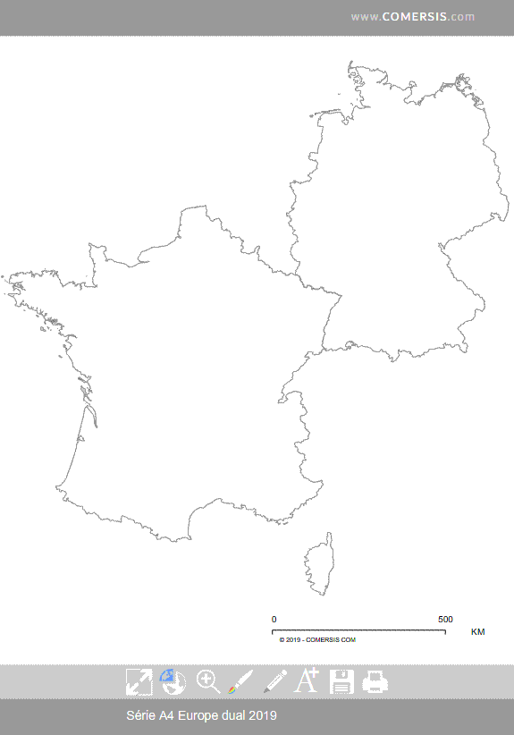
Customizable base map of United Kingdom and France administrative divisions.
Old townships named of France and overseas, vector map layers in Illustrator formats, EPS, PDF and SVG.
Detail of the Paris region.
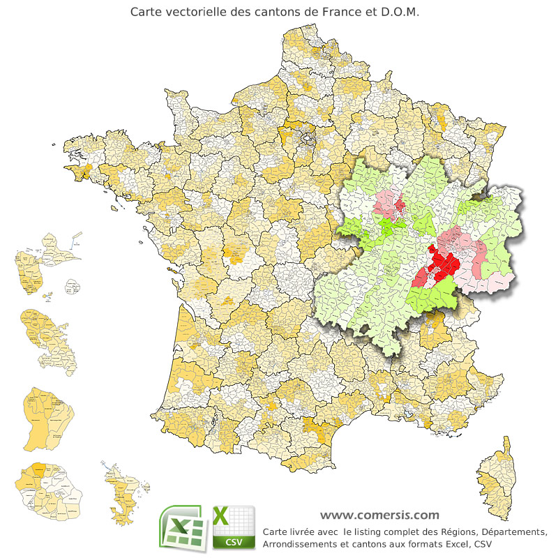
Provided with the Excel and Csv listing of cantons of France (source: INSEE).

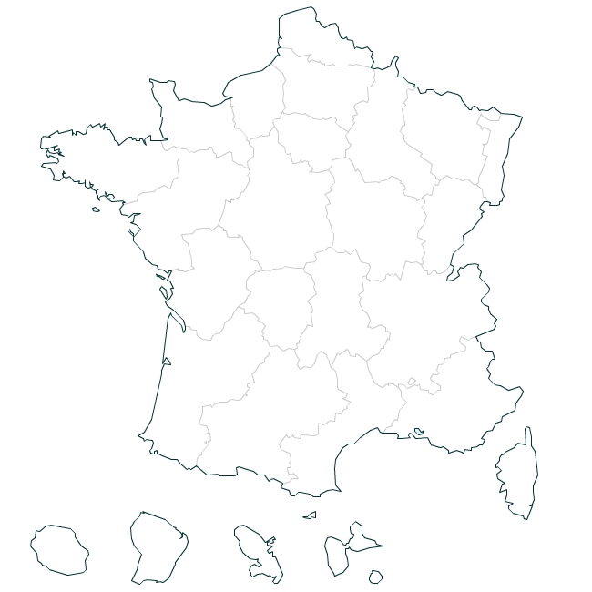
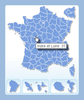
Free clickable map of France no database, configurable as needed. Html 5 Compatible Chrome, Firefox, Internet Explorer 9 and +, Safari, Opera.
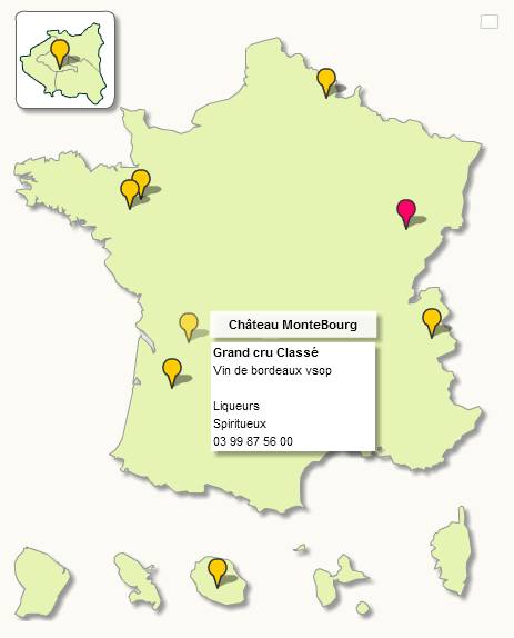
Organize your points on this map of France through the intuitive and complete management. Source files provided.
You can create your own icons and points of interest ...
Unlimited number of points
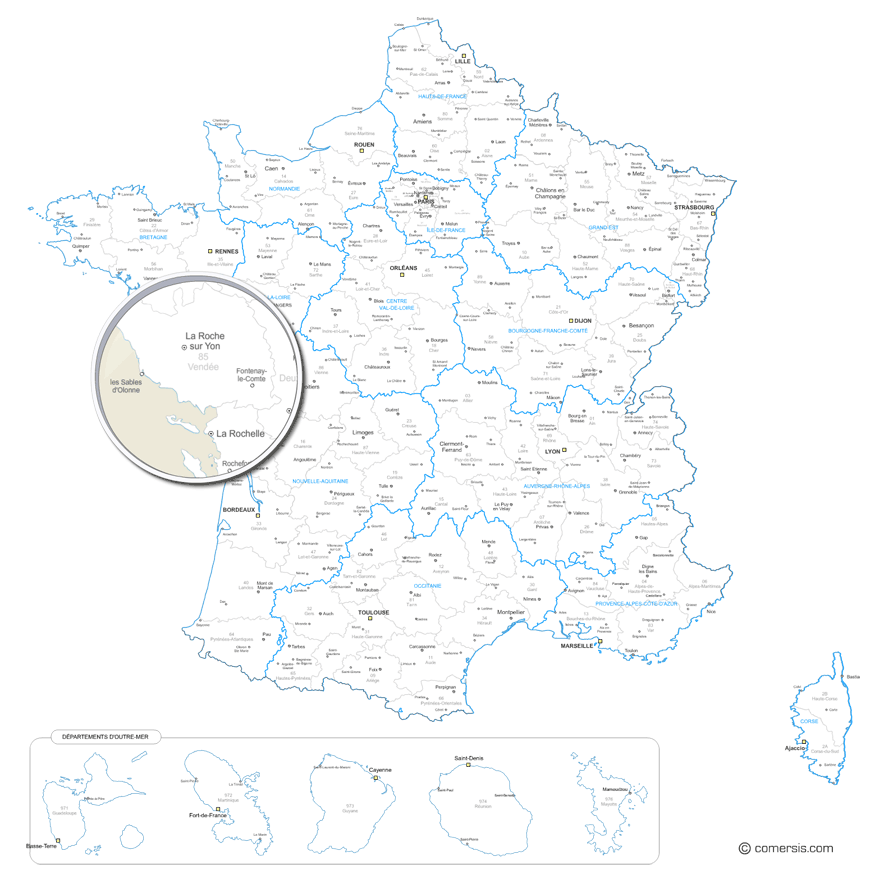
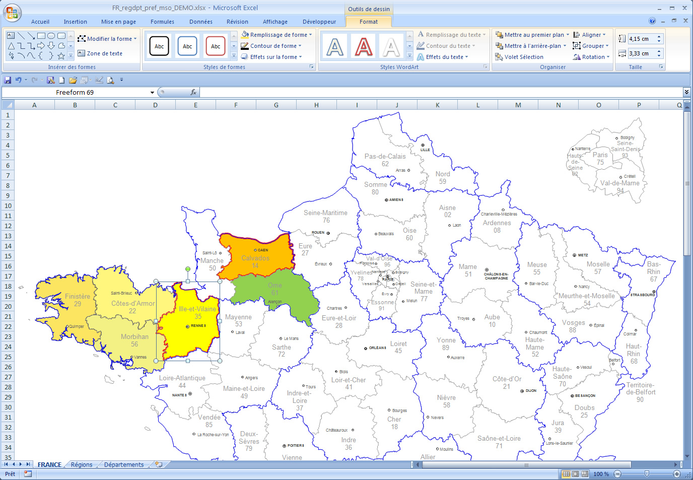
Raster and vector map of the new 2016 regions and departments of France and Dom, with names of departments and capital cities and regional capitals of departments.
Each region or departement is a separated vector object.
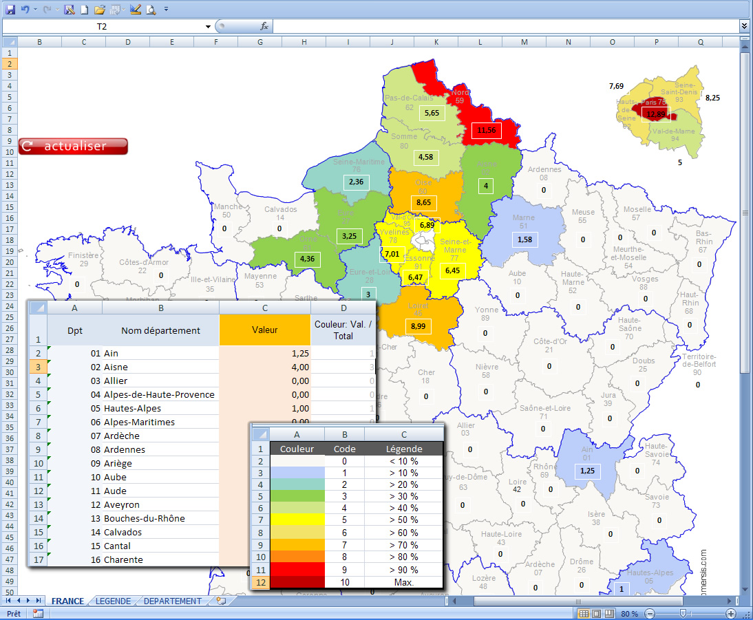
Map of France for Excel : check your datas, select your colors and that's it !
3 maps pack: departements,regions 2015 and new regions 2017.
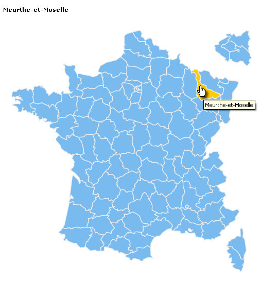
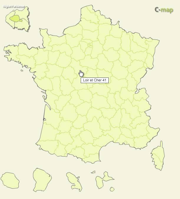
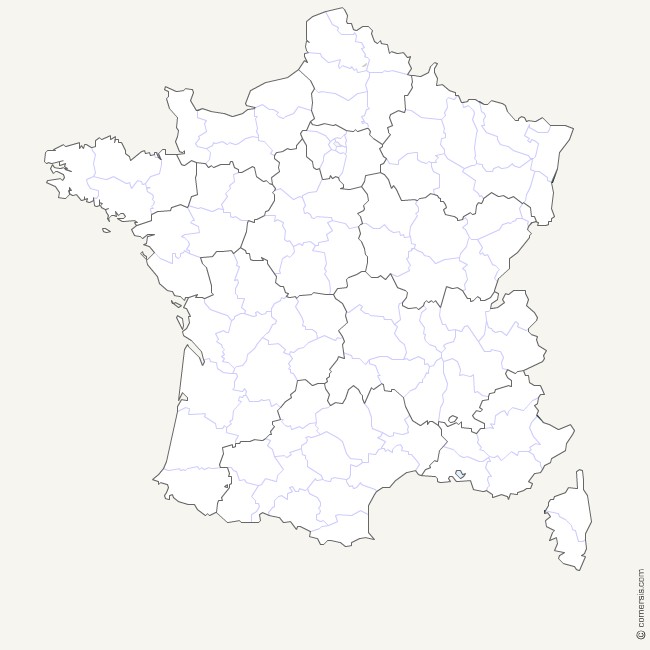
Customizable interactive map of french departements . Compatible with all media.
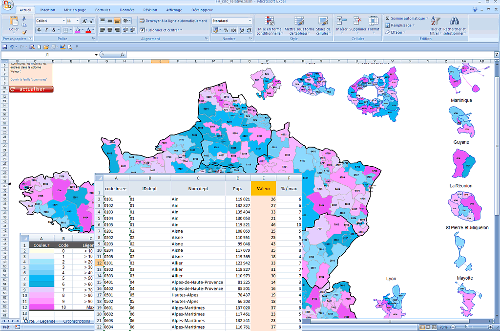
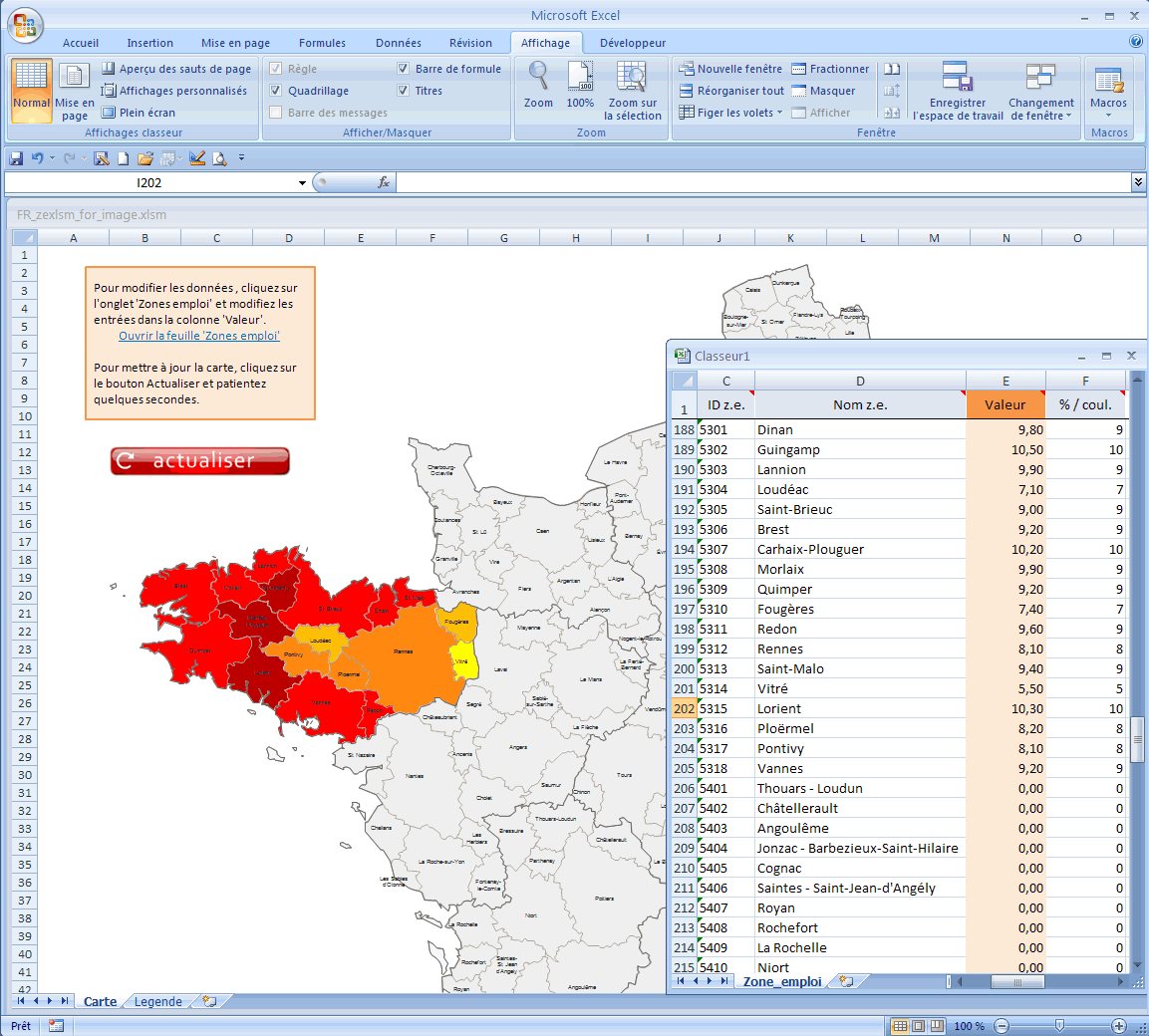
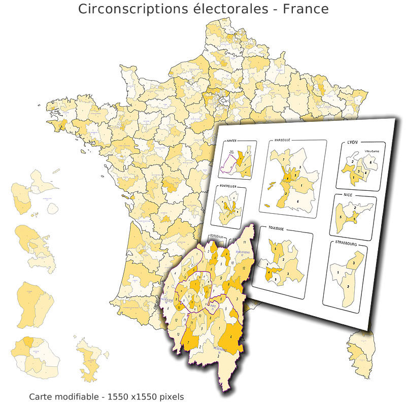
Excel macro map of French constituencies with identifier of the 577 legislative districts, vba code interacting with the map, caption by editable color palette.
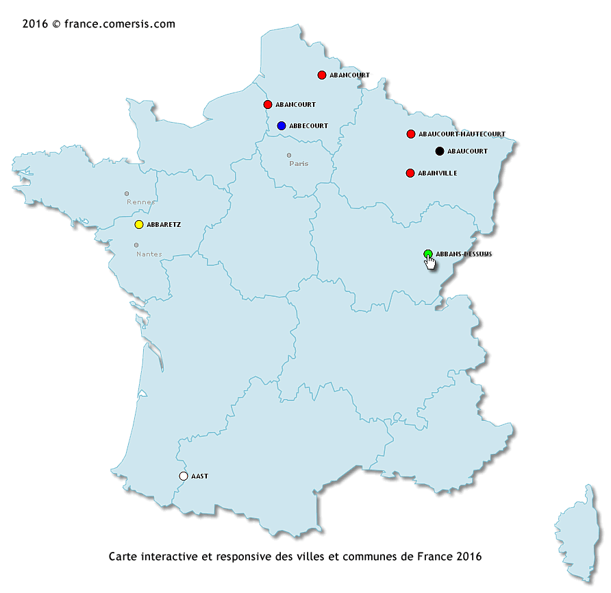
Interactive and responsive map for location of towns and villages in France.

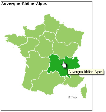
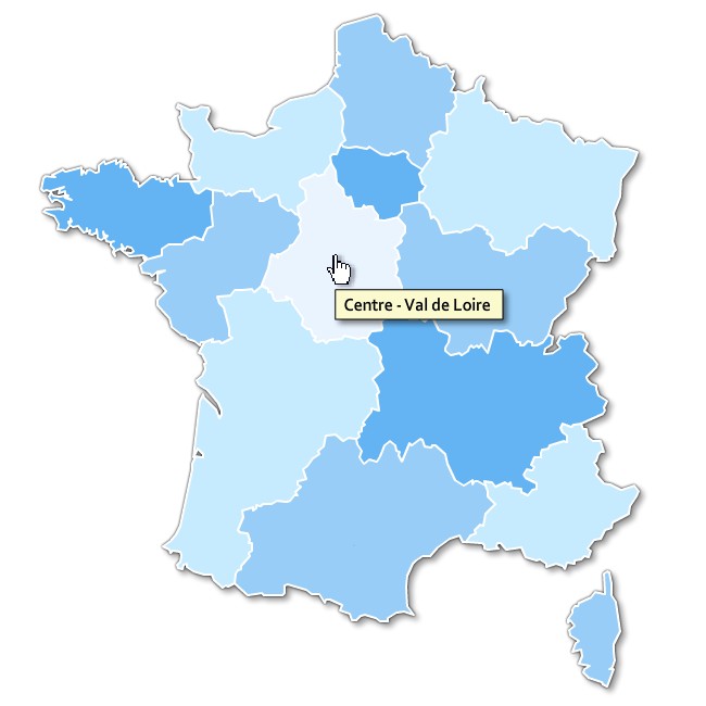
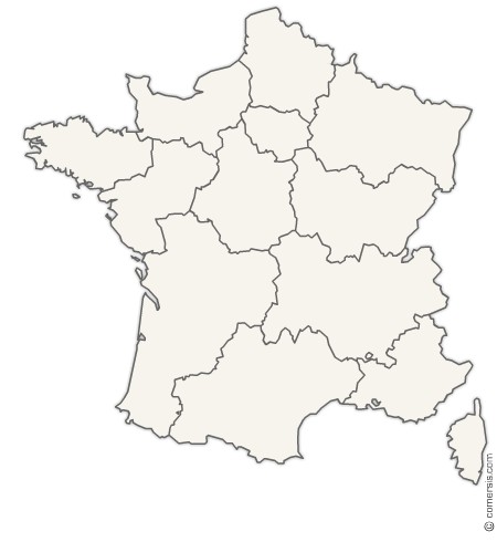
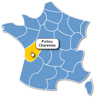
Customizable interactive map of new regions of France. Compatible with all media.
New Regions of France localization clipart map Pack with Dom and Com outlines vector
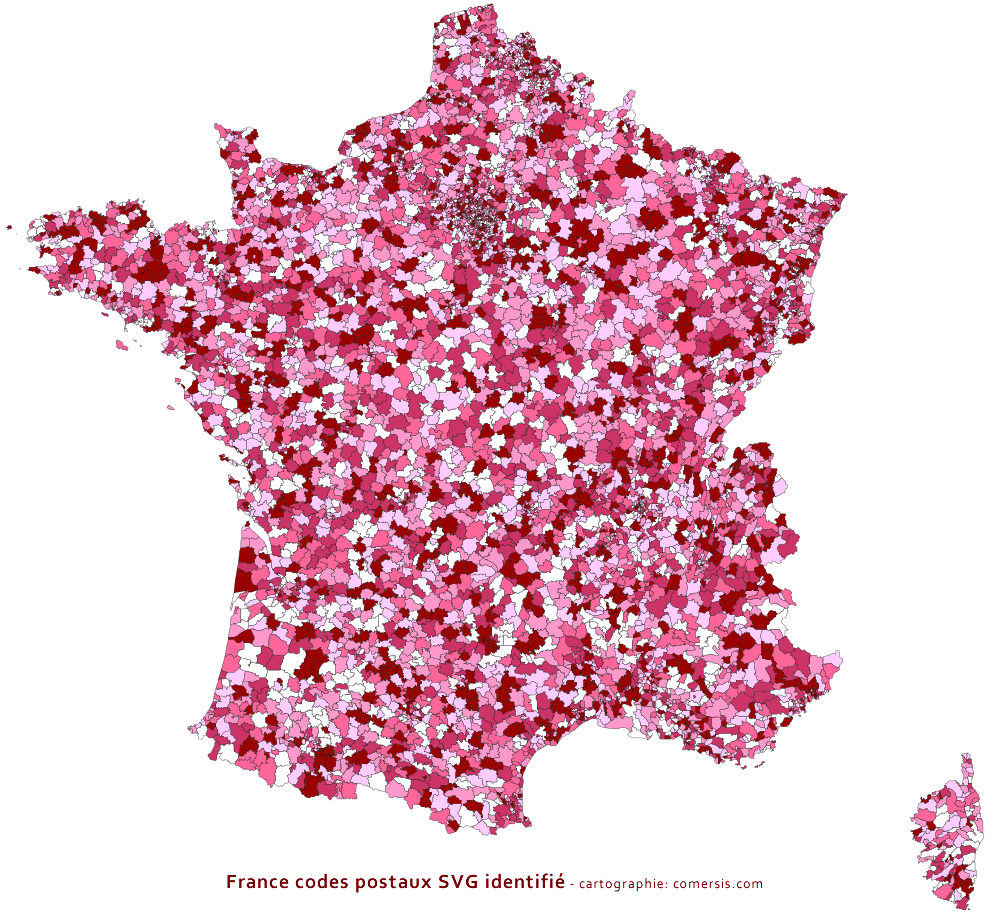
SVG Map of postal areas in France identified by an attribute 'Id' corresponding to the postal code of the area and a 'title' label for the name of this area.
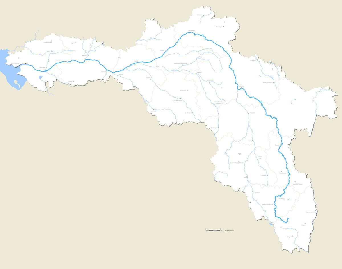
Vector editable map of the whole course of the river La Loire with crossed departmental boundaries and major cities.
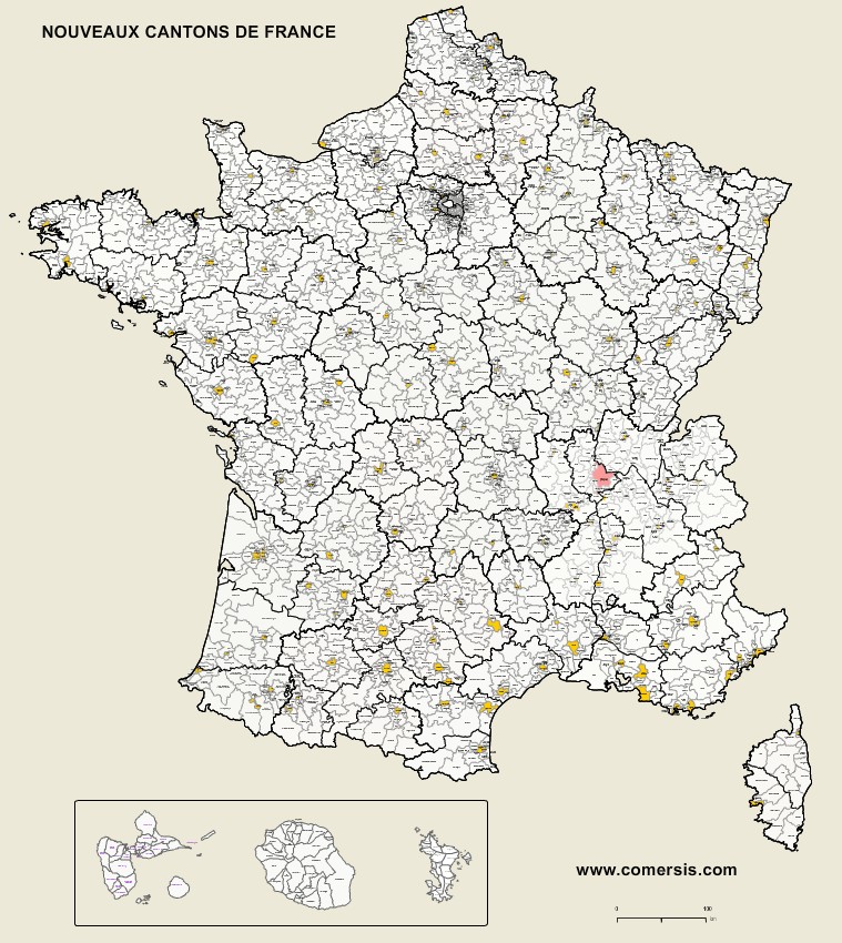
Vector map of the new cantons (districts) of France with Guadeloupe, Reunion and Mayotte.
Each canton is named (non vectorized text).
Editable vector map of French old cantons provided with an Excel and csv list of all cantons.

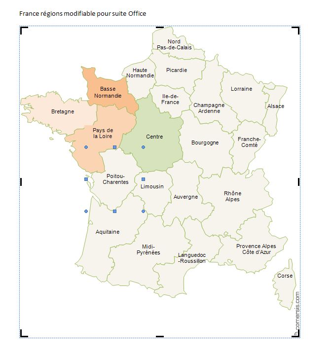
Map of French regions for ms office Word and Excel office software. Free editable map ready to use.
France-region.doc
France-regions.xls
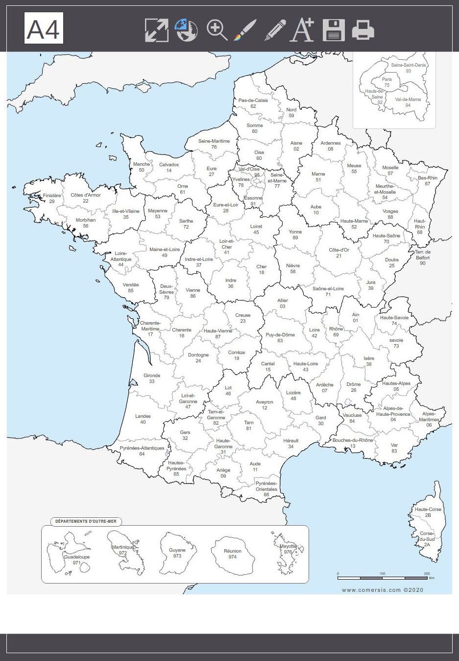
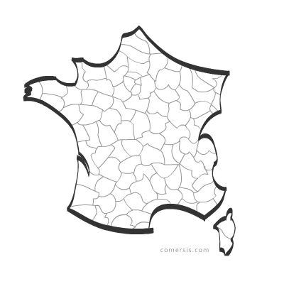
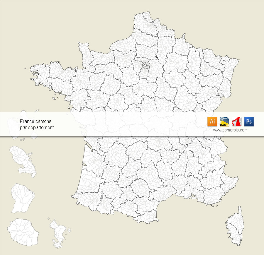
Map Pack of the 101 departments of France for Word, Excel, Powerpoint and Illustrator.

Districts of France, editable vector map layered by regions.
Each district is an independent vector object and can be modified(color, shape, text, dimensions ...)
Map supplied with the listing of the districts of France ( Excel XLS ).
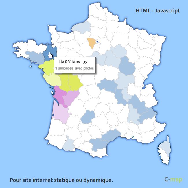
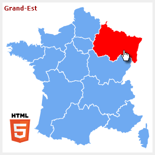
HTML - javascript map with rollout effects. Each province can be link to a distinct URL, receive a distinct color and legend... For static or dynamic web-site (PHP,ASP...)
Test an example of these javascript maps

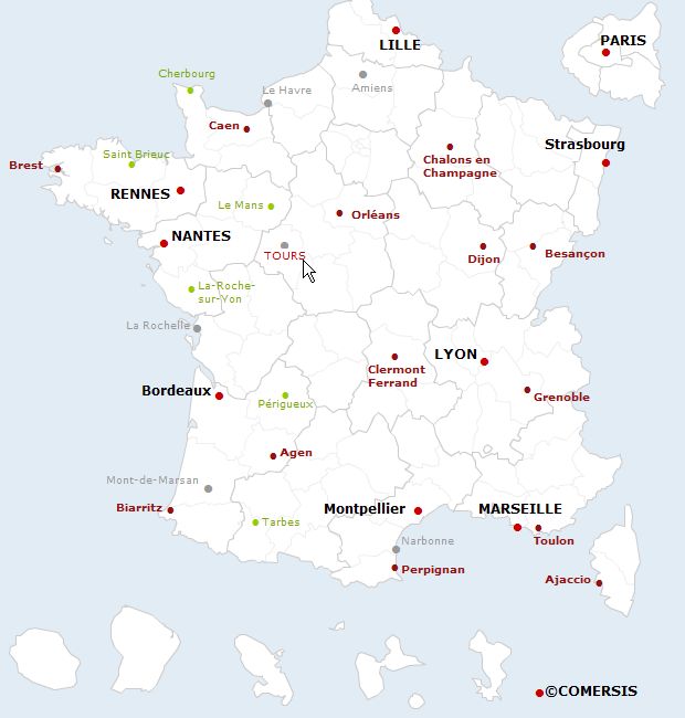
This script allows you to add clickable html links on the map or image of your choice.
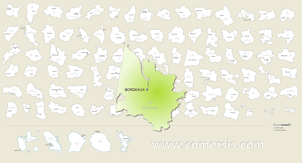
131 metropolitan department
Ain, Aisne, Allier, Alpes-de-Haute-Provence, Alpes-Maritimes, Alsace , Aquitaine , Ardèche, Ardennes, Ariège, Aube, Aude, Auvergne , Aveyron, Bas-Rhin, Basse-Normandie , Bouches-du-Rhône, Bourgogne , Bretagne , Calvados, Cantal, Centre , Champagne-Ardenne , Charente, Charente-Maritime, Cher, Clipperton, Corrèze, Corse , Corse-du-Sud, Côte-d'Or, Côtes-d'Armor, Creuse, Deux-Sèvres, Dordogne, Doubs, Drôme, Essonne, Eure, Eure-et-Loir, Finistère, Franche-Comté, Gard, Gers, Gironde, Guadeloupe (see also separate entry under GP) , Guyane (française) (see also separate entry under GF), Haut-Rhin, Haute-Corse, Haute-Garonne, Haute-Loire, Haute-Marne, Haute-Normandie , Haute-Saône, Haute-Savoie, Haute-Vienne, Hautes-Alpes, Hautes-Pyrénées, Hauts-de-Seine, Hérault, Île-de-France, Ille-et-Vilaine, Indre, Indre-et-Loire, Isère, Jura, La Réunion (see also separate entry under RE), Landes, Languedoc-Roussillon , Limousin , Loir-et-Cher, Loire, Loire-Atlantique, Loiret, Lorraine , Lot, Lot-et-Garonne, Lozère, Maine-et-Loire, Manche, Marne, Martinique (see also separate entry under MQ) , Mayenne, Mayotte (see also separate entry under YT), Meurthe-et-Moselle, Meuse, Midi-Pyrénées, Morbihan, Moselle, Nièvre, Nord, Nord-Pas-de-Calais , Nouvelle-Calédonie (see also separate entry under NC), Oise, Orne, Paris, Pas-de-Calais, Pays-de-la-Loire , Picardie , Poitou-Charentes , Polynésie française (see also separate entry under PF), Provence-Alpes-Côte-d'Azur, Puy-de-Dôme, Pyrénées-Atlantiques, Pyrénées-Orientales, Rhône, Rhône-Alpes, Saint-Barthélemy (see also separate entry under BL), Saint-Martin (see also separate entry under MF), Saint-Pierre-et-Miquelon (see also separate entry under PM), Saône-et-Loire, Sarthe, Savoie, Seine-et-Marne, Seine-Maritime, Seine-Saint-Denis, Somme, Tarn, Tarn-et-Garonne, Terres Australes Françaises (see also separate entry under TF), Territoire de Belfort, Val-d'Oise, Val-de-Marne, Var, Vaucluse, Vendée, Vienne, Vosges, Wallis et Futuna (see also separate entry under WF), Yonne, Yvelines, Auvergne-Rhône-Alpes
 Bourgogne-Franche-Comté
 Bretagne
 Centre - Val de Loire
 Collectivités d'Outre-Mer
 Corse
Corse Départements d'Outre-Mer
 Grand-Est
 Hauts-de-France
 Ile-de-France
 Normandie
 Nouvelle-Aquitaine
 Occitanie
 Pays de la Loire
 Provence-Alpes-Côte d'Azur